
Spanning more than 10,000 hectares of primary subtropical rainforest, jagged karst pinnacles, deep river canyons, and secluded highland plateaus, Ba Be National Park (Vườn quốc gia Ba Bể) is one of Northern Vietnam’s most pristine adventure trekking destinations.
Unlike the terraced slopes of Sapa or the heavily paved pathways of Cat Ba, hiking in Ba Be offers raw, untamed wilderness. Trails range from gentle strolls across lakeside Tay stilt-house villages to demanding multi-day expeditions through primary rainforest canopies, connecting high-altitude Dzao (Dao) and H’Mong mountain settlements.

Whether you are looking for a relaxing half-day cultural valley walk, an exhilarating day hike to panoramic karst viewpoints, or an off-the-grid jungle trek in Ba Be, this comprehensive trekking guide breaks down the best routes, topographic maps, packing essentials, seasonal weather advice, and the crucial reasons to hire a certified local guide.
1. Quick Facts: Hiking in Ba Be National Park
- Terrain: Karst limestone ridges, dense evergreen broadleaf rainforests, bamboo groves, stream crossings, and terraced agricultural valleys.
- Elevation Profile: Lake surface level at ~150 meters up to rugged mountain peaks exceeding 1,500 meters (e.g., Phia Oac / Phia Den boundary ridges).
- Trail Conditions: Ranging from flat paved village footpaths to slippery clay jungle tracks, sharp limestone scrambles, and unmaintained single-track hunting trails.
- Ethnic Encounters: Tay people (lakeside river basins), Dzao Tien / Dao (mid-elevation valleys), and H’Mong (high mountain ridges).
- Wildlife: Home to 330 bird species, 106 species of reptiles and amphibians, and rare primates including the critically endangered Francois’ langur (Trachypithecus francoisi).
- Hanoi to Ba Be private transfer
2. Trail Map & Route Overview
                      [ DAN MAY ] (H'Mong Highland Settlement - 950m)
                            ▲
                            │ (Steep Karst Ascent / 3 hrs)
                            │
                      [ NA NGHE ] (Dzao Tien Village - 650m)
                            ▲
        ┌───────────────────┴───────────────────┐
        │ (Deep Jungle Ridge Trail)             │ (Descent via Nang River)
        ▼                                       ▼
  [ KHAU QUA VIEWPOINT ]                  [ DAU DANG WATERFALL ]
        │                                       │
        ▼                                       ▼
  [ COC TOC VILLAGE ] ◄──── Valley Walk ────► [ PAC NGOI VILLAGE ]
      (Lakeshore)                                 (Lakeshore)
3. Top Hiking & Trekking Trails in Ba Be (From Easy to Demanding)
To help you match your physical fitness and schedule with the right adventure, we have categorized Ba Be’s trekking network into three distinct difficulty grades.
| Route Name | Difficulty Grade | Distance (km) | Duration | Elevation Gain | Key Highlights |
| 1. The Lakeside Village Circuit | Level 1: Easy | 4 – 6 km | 1.5 – 2.5 Hours | +50 m | Pac Ngoi, Bo Lu & Coc Toc villages, stilt architecture, rice fields |
| 2. Khau Qua Mountain Viewpoint | Level 2: Moderate | 8 – 10 km | 3.5 – 4.5 Hours | +350 m | Bamboo forests, limestone ridges, panoramic Ba Be Lake view |
| 3. Na Nghe Dzao Village Day Trek | Level 2+: Moderate-Strenuous | 12 – 14 km | 5.0 – 6.0 Hours | +550 m | Dense secondary jungle, Dzao Tien ethnic culture, herbal tea tasting |
| 4. Deep Primary Rainforest Expedition | Level 3: Demanding | 18 – 22 km (2 Days) | 1.5 – 2.0 Days | +850 m | Dan May (H’Mong), Na Nghe (Dao), primary canopy, Dau Dang Waterfall |
Route 1: The Lakeside Cultural Circuit (Pac Ngoi – Bo Lu – Coc Toc)
- Difficulty: Easy | Distance: 4 to 6 km | Duration: 1.5 – 2.5 hours | Elevation Change: Minimal (~50 m)
- Best Suited For: Families, casual walkers, photographers, and self-guided explorers.
[ Pac Ngoi Village ] ──► [ Leng River Bridge ] ──► [ Bo Lu Village ] ──► [ Coc Toc Lakeshore ]
Route Description & Highlights
This low-intensity cultural walk follows the tranquil southern and western edges of Ba Be Lake. Starting from the traditional stilt-house hamlet of Pac Ngoi, walk along the paved riverside lane bordering cornfields and grazing water buffaloes.
Cross the footbridge over the Leng River toward Bo Lu Village, an authentic settlement of the Tay ethnic minority where wooden houses on stilts rest directly against vertical limestone walls. Continue onward along the shaded lakeshore road toward Coc Toc Village, where local fishermen moor their traditional dug-out canoes (thuyền độc mộc).
- Trail Tip: This walk requires no guide. It is best enjoyed in the late afternoon (03:30 PM – 05:30 PM) when the sun casts a golden glow over the rice terraces and limestone cliffs.
Route 2: Khau Qua Karst Ridge & Viewpoint Trail
- Difficulty: Moderate | Distance: 8 to 10 km | Duration: 3.5 – 4.5 hours | Elevation Change: +350 m / -350 m
- Best Suited For: Active hikers seeking elevated photography panoramas without committing to a full-day expedition.
[ Coc Toc Trailhead ] ──► [ Bamboo Forest ] ──► [ Khau Qua Crest ] ──► [ Mo Ne Hamlet ] ──► [ Bo Lu ]
Route Description & Highlights
Departing from Coc Toc village, the trail immediately leaves the paved flatlands and climbs into dense secondary evergreen forest. You will ascend a shaded dirt track flanked by towering giant bamboo groves (tre vầu) and ancient wild banana trees.
As you reach the limestone crest of Khau Qua, the canopy opens up to reveal a magnificent panoramic overlook: all three basins of Ba Be Lake (Pe Leng, Pe Lu, and Pe Lam) shimmering in emerald hues hundreds of meters below.
From the summit ridge, descend along single-track trails through the small farming hamlet of Mo Ne, winding down through terraced hillside corn patches before looping back to Bo Lu village and the lakeshore.
- Trail Tip: Limestone rocks on the Khau Qua ridge can be sharp and slippery when wet. Sturdy trail runners with aggressive rubber lugs are highly recommended.
Route 3: Na Nghe Dzao Tien Village Day Trek
- Difficulty: Moderate to Strenuous | Distance: 12 to 14 km | Duration: 5 – 6 hours | Elevation Change: +550 m
- Best Suited For: Hikers looking for cultural immersion combined with rewarding jungle climbing.
[ Coc Toc / Park Gate ] ──► [ Karst Canyon Ascent ] ──► [ Primary Forest Border ] ──► [ Na Nghe Village ]
Route Description & Highlights
Na Nghe is a secluded mountain village inhabited exclusively by the Dzao Tien (Coin Dao) ethnic minority, famous for their intricate wax-resist batik textiles, hand-embroidered silver-coin tunics, and traditional botanical herbal medicine.
The trek begins along the valley floor before ascending a narrow, steep mountain path carved through karst canyons and lush sub-tropical jungle. Along the trail, you will cross small mountain streams and walk beneath moss-draped evergreen canopies.
Upon emerging onto the high plateau of Na Nghe (~650m altitude), you are welcomed into wooden homes to enjoy hot herbal forest tea, sweet potatoes, and a traditional lunch prepared by your local host family. You can observe local Dao women crafting natural indigo dyes and traditional clothing before beginning the scenic afternoon descent back to the lake basin.
- Trail Tip: Trail junctions between Coc Toc and Na Nghe are unmarked and split into confusing forestry paths; a local village guide is strongly recommended.
Route 4: Deep Jungle Multi-Day Expedition (Dan May & Primary Rainforest Circuit)
- Difficulty: Demanding / Adventure | Distance: 18 to 22 km (Over 2 Days) | Duration: 2 Days / 1 Night | Elevation Change: +850 m
- Best Suited For: Seasoned trekkers, adventure enthusiasts, and wilderness lovers wanting an off-the-grid expedition.
 [ DAY 1 ]: Coc Toc ──► Na Nghe (Dao Village) ──► Dan May (H'Mong Highland) [Overnight Homestay]
 [ DAY 2 ]: Dan May ──► Deep Primary Forest ──► Dau Dang Waterfall ──► Boat Return across Lake
Day 1: Ascent to High-Altitude Ethnic Settlements
- Distance: ~10 km | Hiking Time: 5 – 6 hours
- Trek out of the lake basin, climbing beyond Na Nghe village into the high-altitude territory of Dan May, an isolated H’Mong settlement perched at approximately 950 meters elevation.
- Hike through thick virgin rainforest where massive ancient trees (nghiến and wild figs) dominate the skyline.
- Arrive in Dan May by late afternoon. Experience genuine mountain hospitality: stay overnight in a rustic wooden home, share dinner cooked over an open hearth, and listen to local folklore.
Day 2: Primary Rainforest Descent & Nang River Canyon
- Distance: ~10 – 12 km | Hiking Time: 4 – 5 hours
- Wake to dramatic sea-of-clouds views over the karst valleys.
- Trek through the core conservation zone of the national park, traversing dense primary jungle tracks teeming with native birdlife, wild orchids, and butterfly colonies.
- Descend the steep northern mountain flank down to the roaring rapids of Dau Dang Waterfall (Thác Đầu Đẳng) on the Nang River.
- Relax with a cold drink and fresh lake fish at a riverside tavern before boarding a private motorized boat for a scenic cruise across the entire length of Ba Be Lake back to Pac Ngoi or Coc Toc.
4. Packing List: Gear Checklist for Ba Be Trekking
Proper gear is essential for safety and comfort in Northern Vietnam’s subtropical karst terrain.
  ┌────────────────────────────────────────────────────────────────────────┐
  │                    ESSENTIAL TREKKING PACKING LIST                     │
  ├────────────────────────────────────────────────────────────────────────┤
  │  [✓] Footwear: Trail running shoes or hiking boots with deep lugs     │
  │  [✓] Clothing: Lightweight, moisture-wicking quick-dry shirt & pants   │
  │  [✓] Weather Protection: Breathable rain jacket or poncho              │
  │  [✓] Pest Defense: High-DEET insect repellent & anti-leech socks       │
  │  [✓] Hydration & Fuel: Minimum 1.5–2.0 liters of water + snacks        │
  │  [✓] Navigation & Light: Offline GPS map (Maps.me) + headlamp          │
  │  [✓] Protection: Waterproof dry bag for cameras, phones & passports     │
  │  [✓] First-Aid: Antiseptic wipes, blister bandages & rehydration salts │
  └────────────────────────────────────────────────────────────────────────┘
- Footwear Warning: Never hike in sandals, flip-flops, or smooth-soled running sneakers. Wet limestone behaves like ice, and jungle clay builds up quickly on non-treaded soles.
- Leech Protection (Summer / Rainy Season): During wet months, land leeches (con vắt) inhabit leaf litter on deep forest trails. Wear high socks tucked into long pants, and spray footwear with insect repellent.
5. Why You Should Hire a Local Native Guide
While short village walks (Route 1) are easily done independently, venturing into the deeper secondary and primary forests of Ba Be National Park warrants a certified local guide.
  ┌───────────────────────────────┐     ┌───────────────────────────────┐
  │     UNNAVIGATED RISKS         │     │     LOCAL GUIDE VALUE         │
  ├───────────────────────────────┤     ├───────────────────────────────┤
  │ • Zero trail signage or blazes│     │ • 100% Safe Route Navigation  │
  │ • Ghost hunting/logging paths │     │ • Direct Ethnic Communication │
  │ • Cell coverage drops to zero │     │ • Flora, Fauna & Herbal Lore  │
  │ • High risk of getting lost   │     │ • Direct Local Economy Impact │
  └───────────────────────────────┘     └───────────────────────────────┘
- Trail Complexity & Lack of Signage: Ba Be National Park’s deep trails have no official English trail markers or blazes. The forest is crisscrossed by logging tracks, foraging paths, and water buffalo trails that easily mislead unguided hikers.
- Safety & Emergency Support: Karst terrain has hidden crevices, sinkholes, and steep slippery drops. In the event of a sprain or injury, local guides know immediate exit paths and maintain contacts with mountain village rescuers.
- Cultural Bridge: Local Tay, Dao, and H’Mong guides speak both Vietnamese and ethnic dialects, allowing you to converse respectfully with villagers, learn about traditional customs, and arrange authentic homestay meals.
- Direct Eco-Tourism Support: Hiring a guide directly supports local families, incentivizing the preservation of primary rainforests over illegal logging or agricultural clearing.


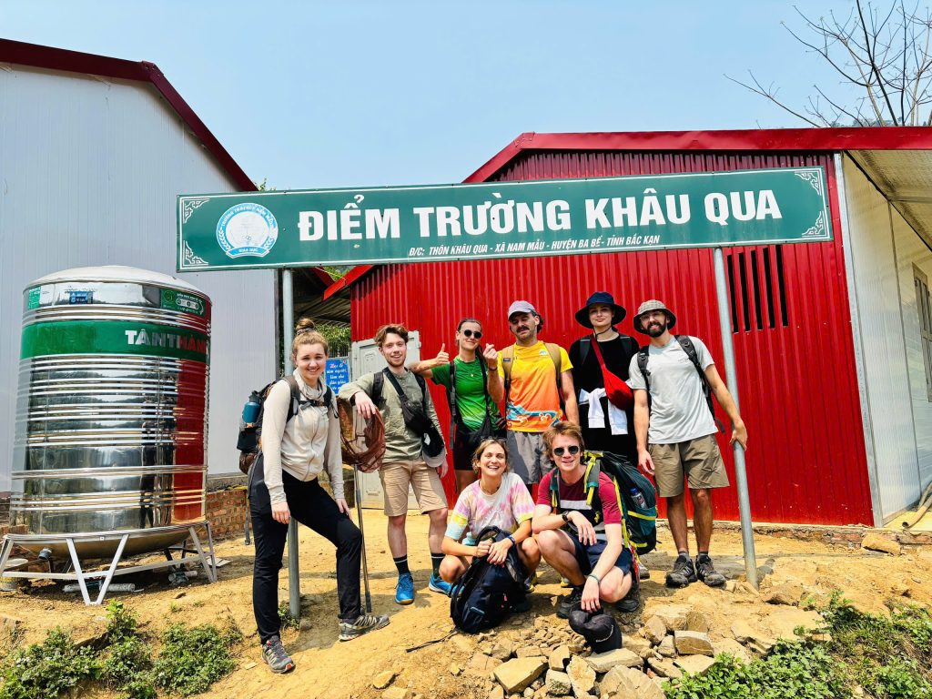


6. Best Season for Trekking in Ba Be
- Autumn (September – November) – The Golden Hiking Season: Crisp dry air, comfortable daytime temperatures (19°C – 25°C), low humidity, and vibrant golden rice terraces across the valleys. Trails are dry with minimal leech activity.
- Winter (December – February) – Cool & Invigorating: Cool to cold mountain temperatures (10°C – 16°C) with ethereal morning mists. Excellent for high-exertion climbing without overheating. Pack warm thermal layers for nights in mountain homestays.
- Spring (March – April) – Lush & Blooming: Moderate warmth, fresh green jungle foliage, and blooming wild peach and plum trees along ethnic village trails.
- Summer (May – August) – Challenging & Wet: High heat (28°C – 34°C) and frequent monsoon afternoon downpours. Trails become muddy and slippery, and leeches are active. However, this season offers the most lush rainforest colors and roaring waterfalls. Combine morning hikes with afternoon swims in Ba Be Lake.
7. Combining Trekking with Lake Boating & Kayaking
The ultimate way to experience Ba Be National Park is an integrated multi-sport adventure that merges high-altitude trekking with water exploration:
  [ Morning ] ────► Deep Jungle Ridge Trek from Coc Toc to Dau Dang Waterfall
                          │
  [ Midday ] ─────► Riverside Fish Lunch at Dau Dang Rapids
                          │
  [ Afternoon ] ──► Board Private Wooden Boat to Cruise Puong Cave & Fairy Pond
                          │
  [ Sunset ] ─────► Kayak / SUP across Pe Lu Basin to Widows Island
This hybrid approach allows you to hike across the mountain spine one way, eliminating the need to backtrack on foot, before relaxing on the water during the return journey.
Ba Be Lake and Ban Gioc Waterfall tour.
8. Frequently Asked Questions (FAQ)
How difficult is trekking in Ba Be National Park?
Trekking difficulty depends on the route. Lakeside village walks are flat and easy for all ages. However, jungle trails like Na Nghe and Dan May involve steep ascents over rocky limestone ridges and require moderate to high cardiovascular fitness.
Are there leeches on the Ba Be trails?
During the dry months (October through April), leeches are virtually non-existent. In the warm rainy season (May through August), land leeches are present in deep, wet primary forest leaf litter. They are harmless but annoying; wearing long pants, high socks, and applying insect repellent effectively deters them.
Can I do jungle trekking in Ba Be independently without a guide?
You can walk the lakeside paths between Pac Ngoi, Bo Lu, and Coc Toc independently. However, deep jungle trails to Na Nghe, Dan May, and primary rainforest zones should not be attempted without a local guide, as trails are unmarked, satellite GPS can be erratic under dense canopies, and mobile phone reception is unavailable.
Where do you sleep during multi-day treks?
On multi-day expeditions, you sleep in authentic wooden stilt houses or timber homes hosted by ethnic Dzao (in Na Nghe) or H’Mong (in Dan May) families, equipped with clean mattresses, mosquito nets, hot water, and home-cooked family dinners.
